In a catastrophic event (e.g., tornado, severe snow storm, or earthquake), much of the electrical infrastructure can be damaged or destroyed. The US Power Grid is a critical infrastructure and a catastrophic failure would result in huge humanitarian and economic loss. In addition, a widespread power outage would affect the readiness and response capabilities of various security agencies including Department of Homeland Security (DHS), local police, Department of Defense (DoD), etc. Tools to efficiently assess the status of the Power Grid will provide first responders with the tools to understand the damage, assess the time to recovery, and prioritize critical sections of the Power Grid.
RAPID Radar is a wide area aerial surveillance tool to identify and map the powerlines in a Power Grid. The tool can be used to get a scan of a healthy system or more importantly in the aftermath of a catastrophic event.
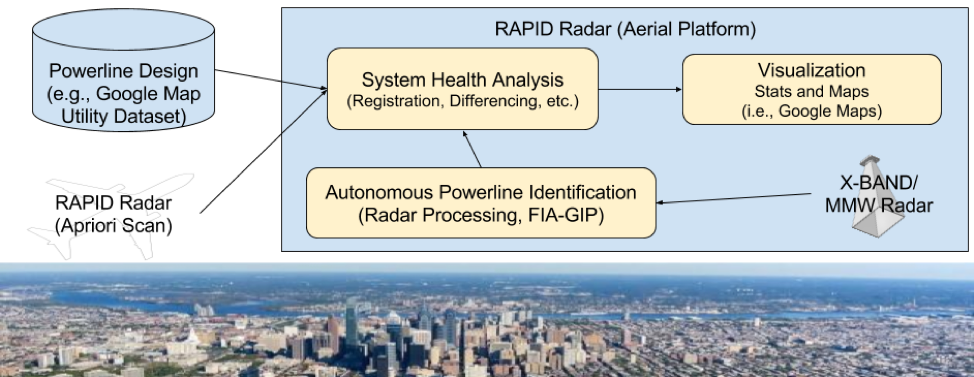
Following an outage, an aerial platform will be deployed to survey the affected area and collect the radar scans. The aerial platform will be outfitted with MMW or X-Band radar and will be flown in a predetermined pattern to fully cover the area of interest. The proposed autonomous powerline identification algorithms will be used to process the radar returns to identify powerlines. The identified powerlines will be registered to known databases of powerlines (e.g., Google Maps Utilities or existing proprietary design data), using geo-registration and alignment. Once the identified powerlines are identified and compared they can be mapped (e.g., using Google Maps).